Mint Springs Park; Crozet, VA; 5/29/19
All photos are © Marshall Faintich
It was already 82 degrees here in Crozet at 9:00 a.m., and with mid-90s and afternoon thunderstorms forecasted, I decided to stay close to home and get to a bit cooler elevation. I went over to nearby Mint Springs Park where I had seen several warbler species during the past few weeks. I wanted to see if I could find a Canada Warbler there, as this species has eluded me so far in 2019. My usual hike there is up the steep Fire Trail for 0.5 miles to where it levels off, and about 0.25 mile along the fairly level trail, and then back down the same way. Only once, several years ago, did I hike the entire Fire Trail. I remembered it being a long hike, but more gradual than the ascent to the level area.
The trail map to the right shows where I started. About a third of the way up, a Hooded Warbler appeared, and it followed me for quite a while. About two-thirds of the way up, I saw a Kentucky Warbler, and then I heard two Worm-eating Warblers when I reached the level trail area.
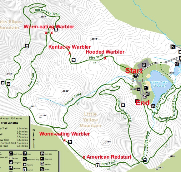
Trail map
| | |
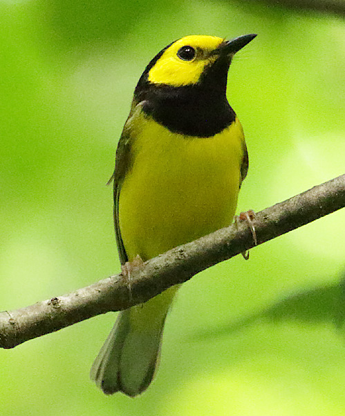
Hooded Warbler
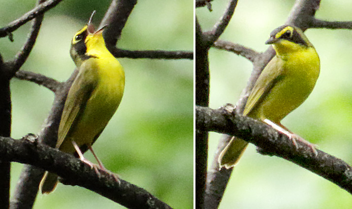
Kentucky Warbler
I decided to hike the rest of the Fire Trail, in hopes of finding a Canada Warbler. After a while, I realized why the Fire Trail seemed so long, as the entire trail was only 1.9 miles. Once I started down from the level area, it was fairly steep both up and down, and I was getting worn out, both from the heat and from constantly swatting flies away from my face. When I reached the fork in the trail and had to choose between continuing on the Fire Trail or taking the Hollow Trail, I had a dilemma. I didn't have a trail map with me, and I didn't know which route would be the hardest, and I didn't want to go back. I opted to continue on the Fire Trail, as I knew that it would eventually getting me back down. I picked incorrectly, as the Hollow Trail would have cut off about 0.5 miles of the hike. When I got to the fork that shows maintenance road, I took that fork. The trail signage didn't show what it was, but it was really steep and downhill, and the Fire Trail was heading up again. At this point, I still didn't know how much longer I would have to hike, and I couldn't get enough cell service to find an on-line map on my iPhone. The only consolation was that I got some photos of a Worm-eating Warbler, and heard an American Redstart.

Worm-eating Warbler
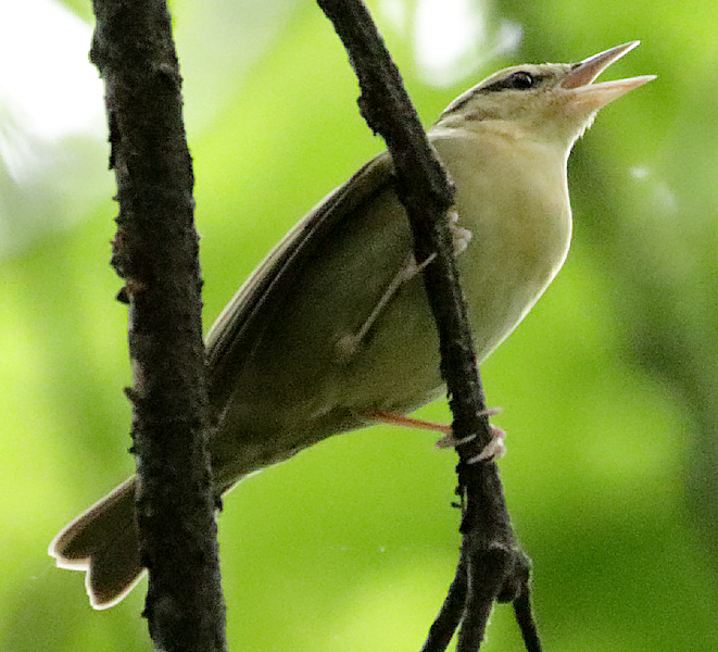
Worm-eating Warbler
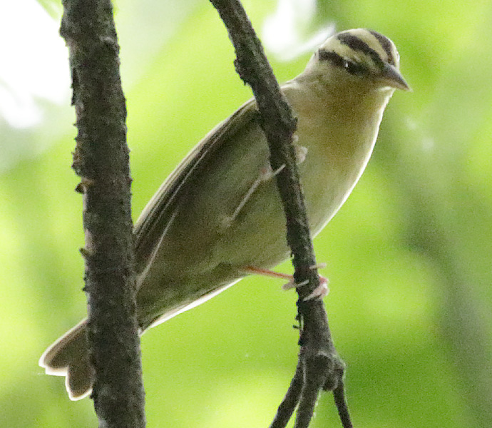
Worm-eating Warbler
I saw a few more species when I reached the end of the trail. Next time, I am taking a trail map with me!
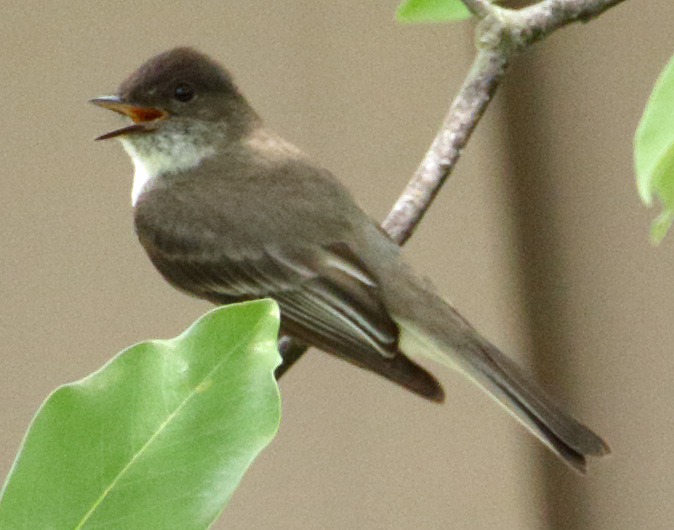
Eastern Phoebe